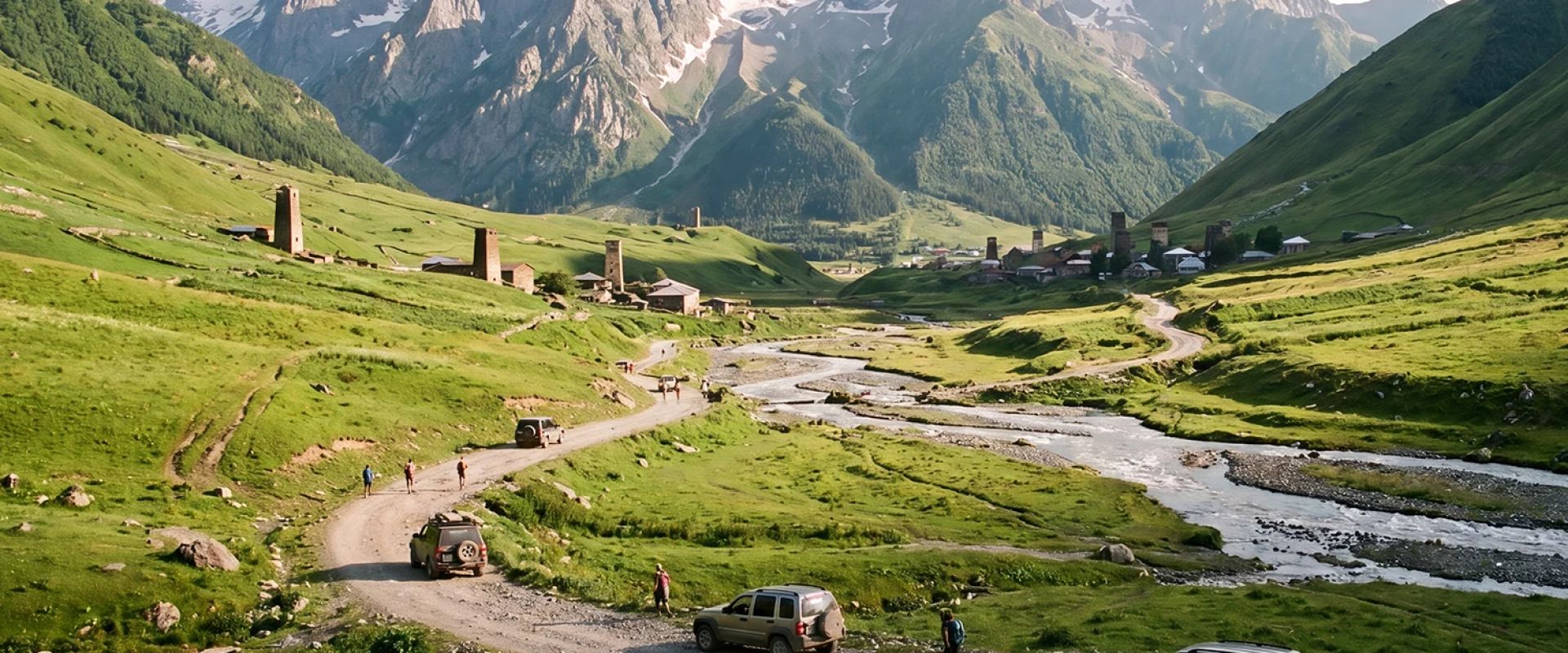
The route to Juta, stop by stop
11 stops · Sno → Juta · ~11 km-
01
Sno valley — the last asphalt
42.5955° N, 44.6529° EAsphalt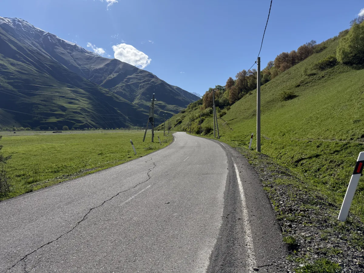
The sealed valley road near Sno — cracked in places, but comfortable for any car. After the turnoff the road runs as quiet, sealed tarmac along the valley floor past Sno village. It’s cracked in places but easy driving for any car — and it’s the last asphalt of the trip. Top up on everything before you turn off the main road: fuel, cash, food. After the turn there are only cafés along the way.
-
02
The tarmac runs out
42.5761° N, 44.6819° EGravel Potholes Livestock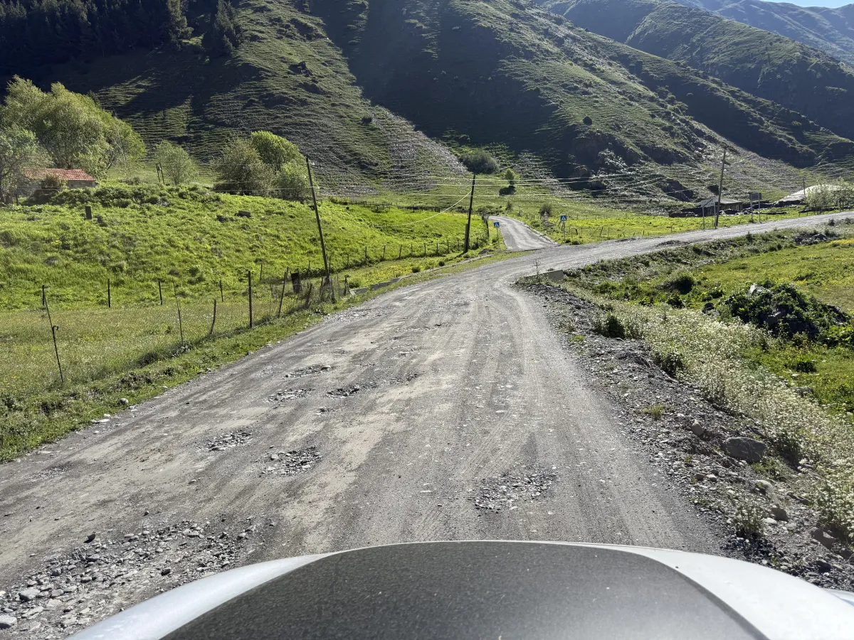
Past the Karqucha village the surface drops to potholed gravel. Past the last farms the asphalt ends and the road drops onto gravel full of potholes. You already need some ground clearance here. Take it slowly, pick your line around the worst holes, and watch for dogs and livestock near the farm buildings.
-
03
Into the narrowing valley
42.5709° N, 44.6936° EGravel Potholes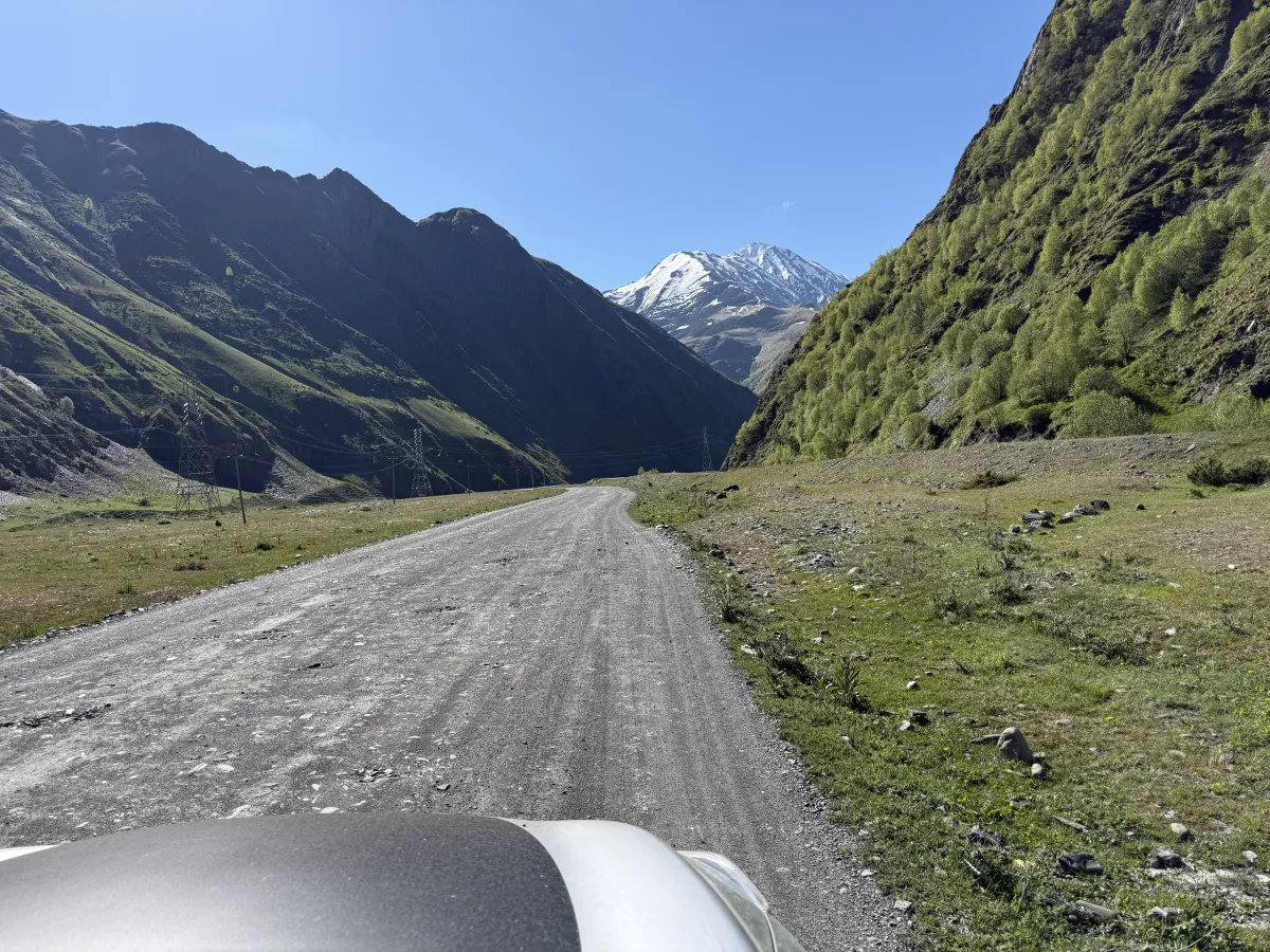
Rougher gravel as the valley walls close in — snow peaks straight ahead. The valley tightens and the gravel gets rougher — not so well graded here, and the potholes keep coming. The reward is the view: big snow peaks fill the windscreen for the whole stretch.
-
04
The bridge — first danger sign
42.5621° N, 44.7066° EGravel Can't go further in the snow season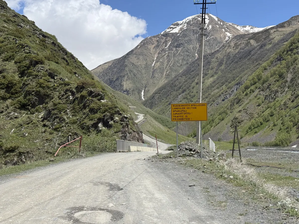
The bridge over the river — the usual turning point when there is snow. A short bridge takes the road over the river. When there is snow on the mountains, this is usually the spot where it’s better to stop and turn back — the road beyond gets cut off first. Outside the snow season you can carefully continue the journey.
-
05
Under the rock cut
42.5628° N, 44.7104° EGravel Rockfall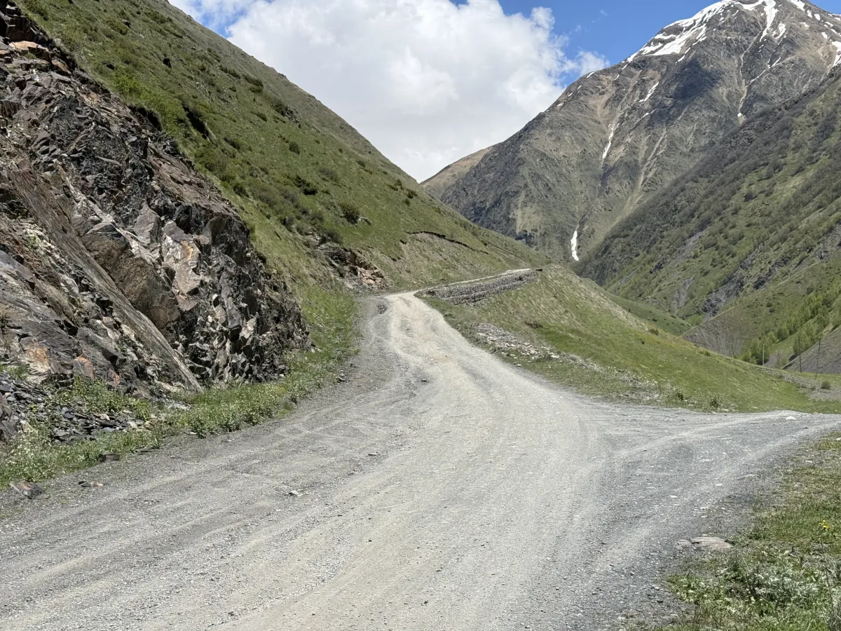
The road swings beneath dark crags — rockfall country starts here. The track bends under dark rock walls, with a stone retaining wall carrying the road ahead. Loose stones on the surface are normal here. Glance up before blind corners, keep moving, and don’t stop under the crags for photos.
-
06
The parking spot
42.5644° N, 44.7236° EBroken Parking spot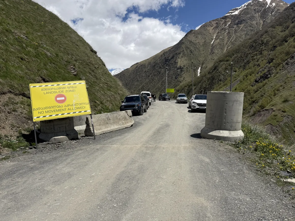
The wide spot where many drivers leave the car and continue on foot. If you don’t have a proper off-road vehicle, it’s better to stop here and continue the journey on foot — the hardest stretch starts just ahead, and Juta is about 4 km of easy walking. There is room to leave the car by the concrete blocks. With a capable 4x4 you can drive on.
-
07
Crossing the scree
42.5653° N, 44.7247° EBroken Loose rock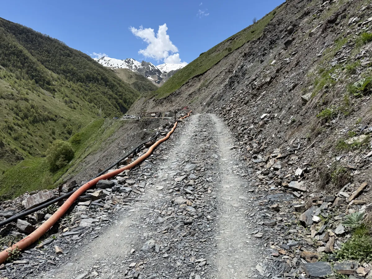
The road cut straight through a loose scree slope. The road crosses a wide field of loose, sharp slate that keeps sliding down the hillside. A good car with solid clearance is needed here. Keep a steady pace, don’t stop in the middle of the slope, and go easy on your tyres.
-
08
The cut-bank climb
42.5705° N, 44.7344° EGravel Ruts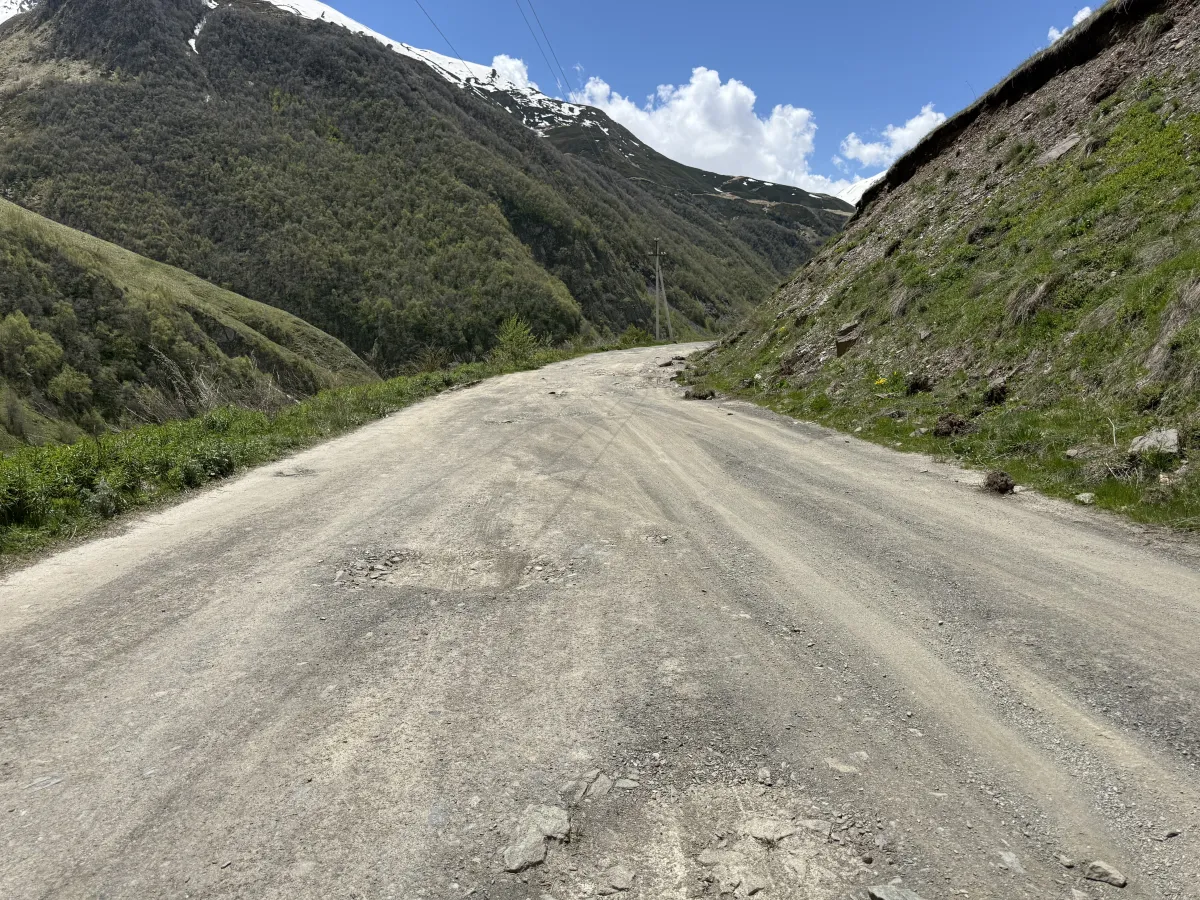
Broad but rutted gravel climbing beside a steep earth bank. The road widens and climbs past a steep earth bank. Trucks have chewed the surface into ruts and shallow potholes — pick the smoothest line early instead of swerving late. There is room for two cars at sensible speeds.
-
09
First huts of the upper valley
42.5773° N, 44.7402° EGravel Blind bends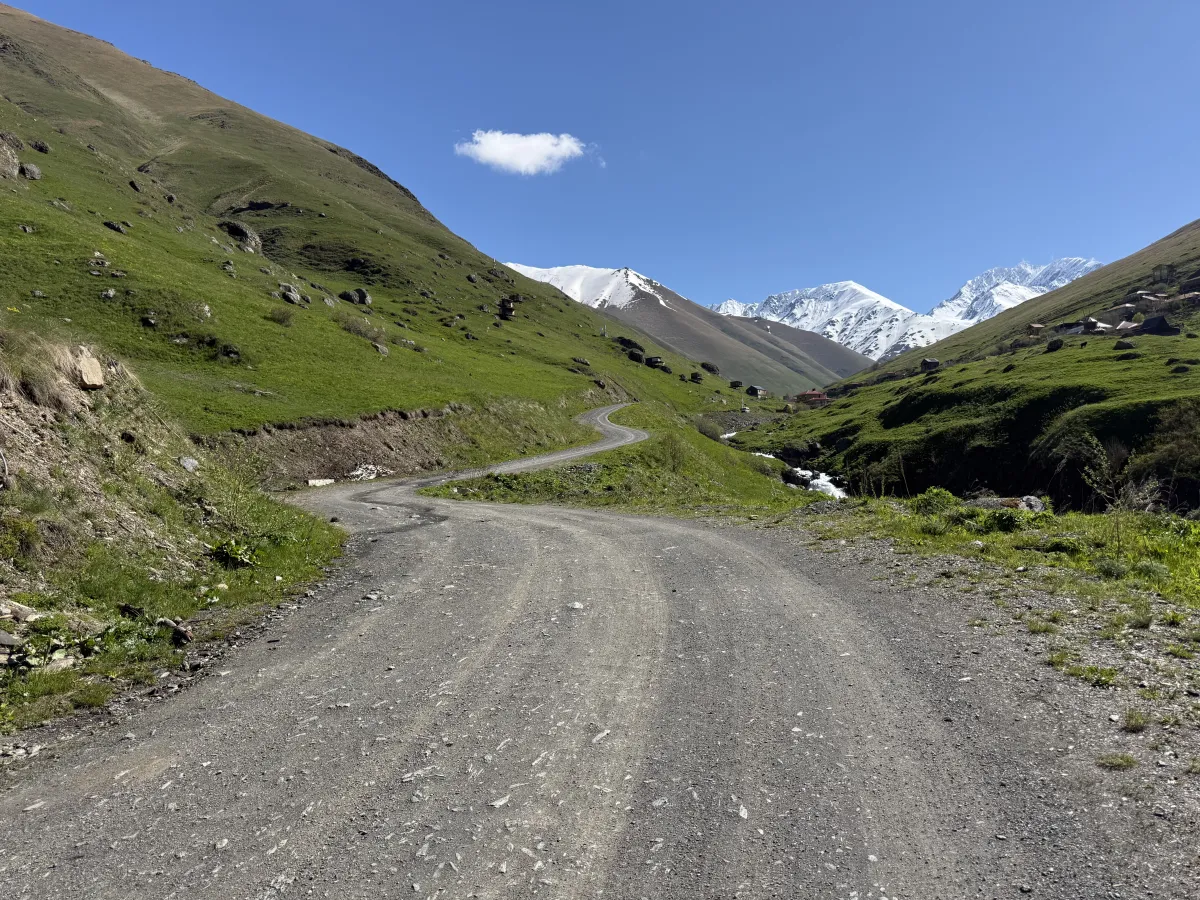
S-curves drop to a stream, the first upper-valley buildings on the slopes ahead. The track winds down to a stream in a chain of S-bends, and the first scattered huts of the upper valley appear on the slopes — Juta is close now. The bends are blind over the grassy shoulders, so keep your speed down and hold your side of the road.
-
10
The avalanche-debris squeeze
42.5794° N, 44.7425° EBroken Avalanche debris Mud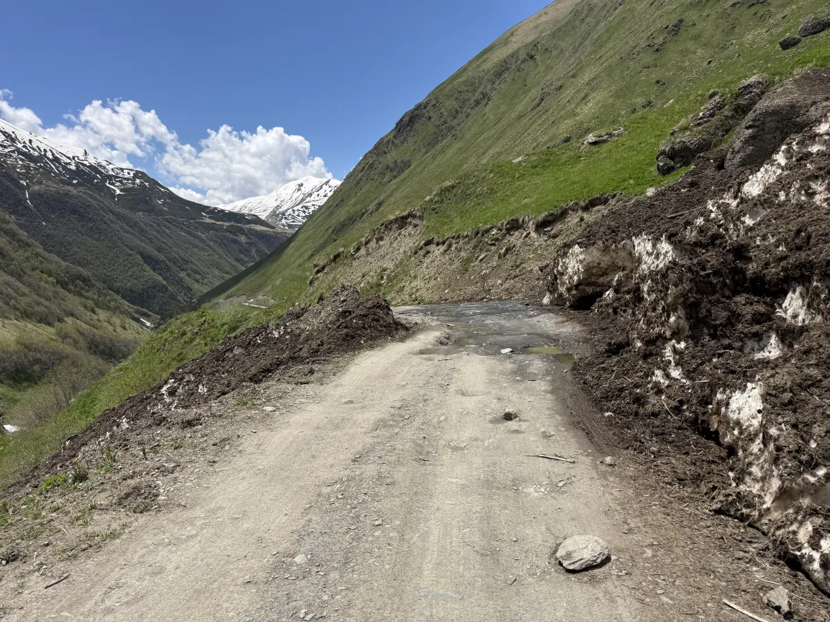
Old avalanche snow pinches the road to a single wet lane — the last squeeze before Juta. This is the last pinch right before entering Juta. Well into June, old avalanche snow can squeeze the road to a single muddy lane, with rock and meltwater across the surface. It changes week to week — crawl through steadily, expect standing water, and be ready to back up if you meet someone halfway.
-
11
Past Juta — the road ends (2,230 m)
42.5883° N, 44.7591° EBroken Meltwater on road No road ahead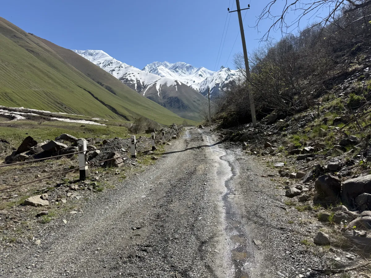
Just past Juta the track stops at the border police post — no road beyond. This stretch sits just past Juta itself and ends at the border police post — there is no road ahead, only hiking trails. Leave the car at the gravel pull-offs by the guesthouses in the village and walk from here. Juta is one of the highest villages in the Caucasus and the starting point for the Chaukhi Pass hike, so arrive early in season — parking and turning room are tight.
Before You Set Off for Juta
Four things to sort out before your trip to Juta.
-
Fuel up first
The last petrol stations are in Stepantsminda. There is no fuel anywhere in the Sno Valley — leave with at least half a tank for the round trip.
-
Download offline maps
Mobile signal fades above Sno village and is patchy in Juta. Download offline map before you lose coverage.
-
Carry some cash
Guesthouses and cafés in Juta sometimes are cash-only (lari). The nearest ATM is back in Stepantsminda — withdraw before going to Juta.
-
Check conditions that day
After rain the river crossing runs deeper and the hairpins turn greasy. Check weather forecast beofore your trip to Juta — or message us and we'll tell you what we know.