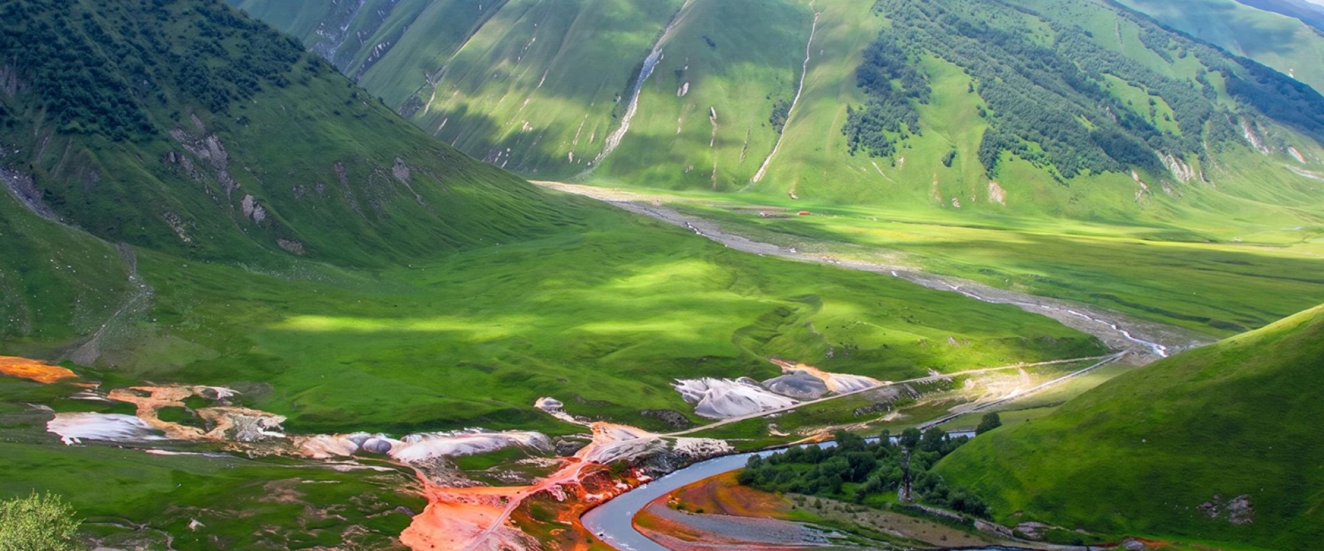
The Truso gorge, stop by stop
10 stops · Okrokana → Ketrisi · ~3.6 km-
01
Valley mouth — the first gravel
42.5630° N, 44.4921° EGravel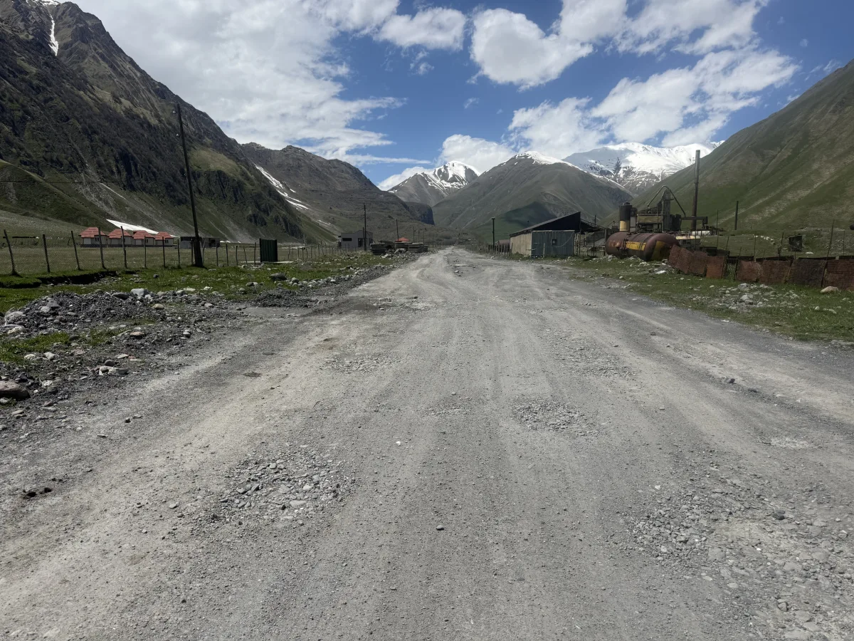
The wide gravel floor of the Truso valley near Okrokana — easy going to start. The road enters the Truso valley as wide, compacted gravel. The surface is stony but even — any car will manage at a calm pace. Stock up before you start: deeper in the gorge there are no fuel stations or shops, only mountains and a few scattered villages.
-
02
Rougher gravel
42.5660° N, 44.4879° EGravel Livestock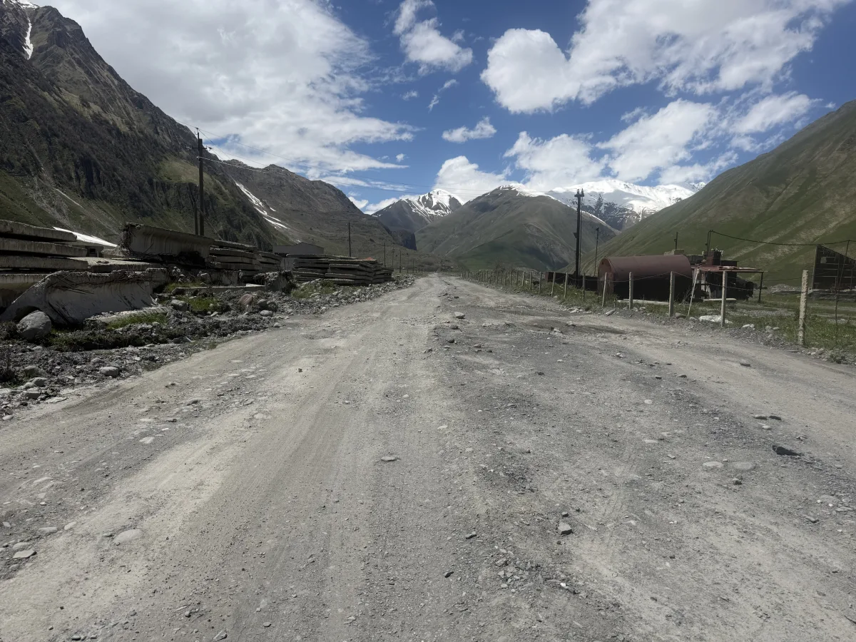
Stonier gravel with old snow patches and farm sheds along the road. The surface turns stonier, with patches of old snow still lying along the verge. Sheds and farm buildings line the road — slow down and watch for livestock and dogs that may wander onto the track. Still flat, but it starts to rattle.
-
03
Horrible road with great views
42.5683° N, 44.4849° EGravel Braided tracks First bumps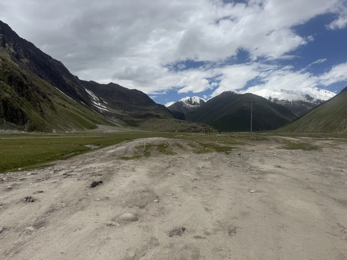
A wide braided flat where tracks split — keep to the main line. The valley opens into a wide flat where the track braids into several lines — some peel off to fords and meadows. Stay on the main compacted line heading up-valley along the power poles, and avoid the soft ground near the river. This is also where the first real bumps and stony potholes begin — the smooth opening stretch is over, so ease off the speed from here on.
-
04
Great views, brutal bumps
42.5738° N, 44.4771° EGravel Brutal bumps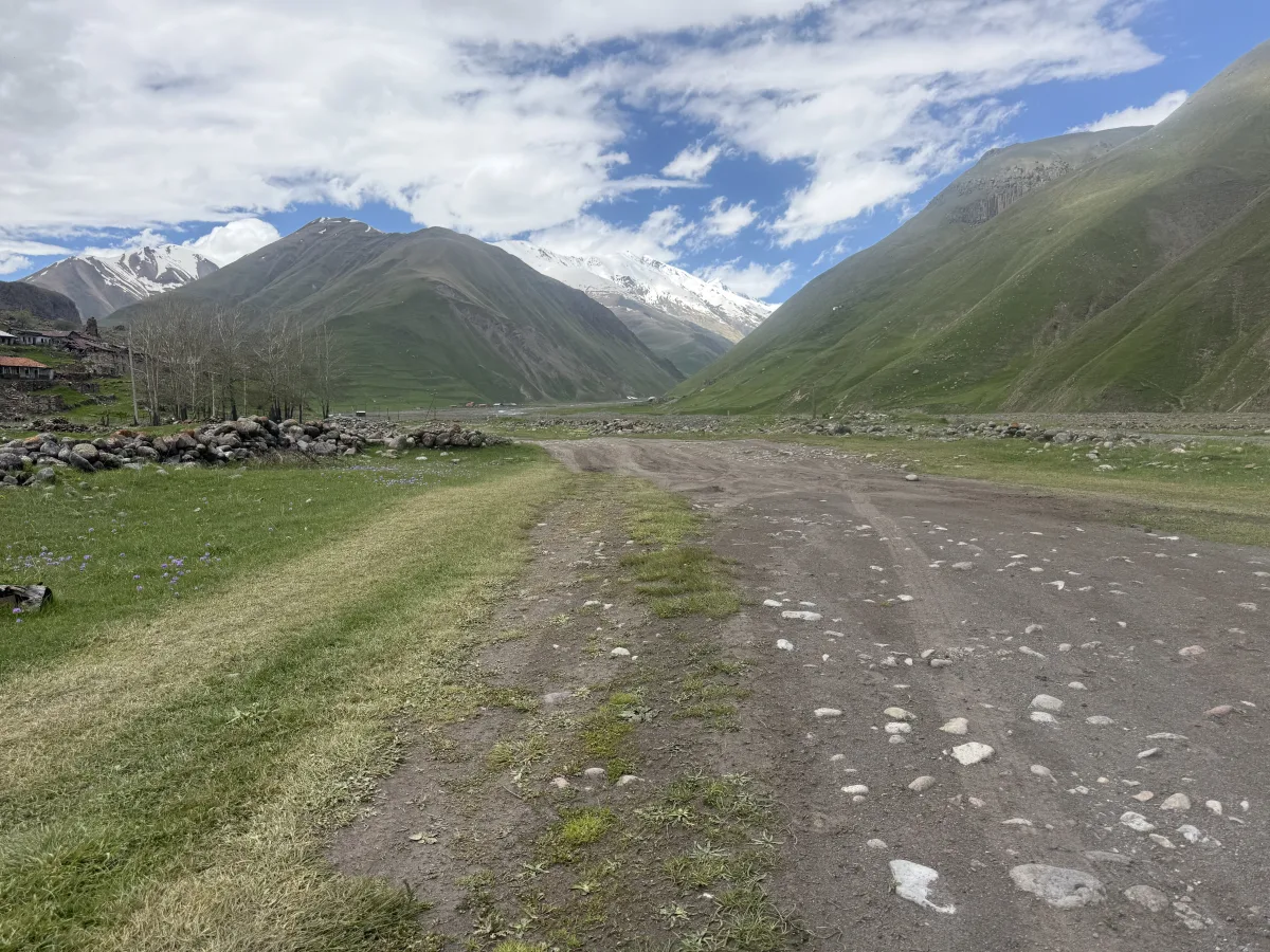
Two stony wheel-tracks with a grass strip between, meadows on both sides. The road narrows to two stony wheel-tracks with a strip of grass down the middle, and from here you get some of the best views in the whole valley — green slopes and snow peaks all around. Don’t let the scenery distract you: hidden stony bumps and sharp edges here are brutal enough to wreck a wheel or your suspension if you hit them at speed. Keep it slow.
-
05
The ford — standing water
42.5749° N, 44.4759° EBroken Water Mud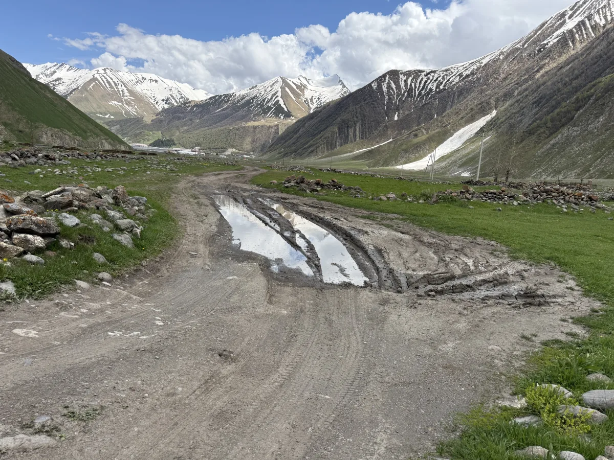
Meltwater pools and muddy ruts cross the track — pick your line. Meltwater stands across the road here and the ruts run deep with mud. The depth changes week to week; if you are unsure, walk it first or watch another car go through. Keep steady throttle, skirt the deepest ruts, and don’t stop in the middle. Clearance pays off.
-
06
Under the eroding slope
42.5807° N, 44.4675° EBroken Landslide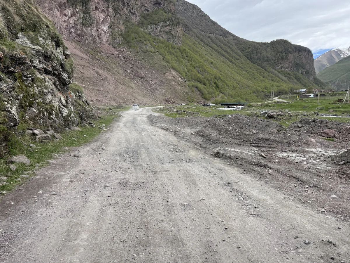
The road runs beneath a raw, eroding hillside — loose material on the surface. The road passes beneath a raw, eroding slope — loose stones and washed-out earth often lie on the surface here. Glance up before the bends, don’t stop beneath the slope, and clear this stretch without lingering.
-
07
The parking spot
42.5809° N, 44.4646° EGravel Parking spot Hiking start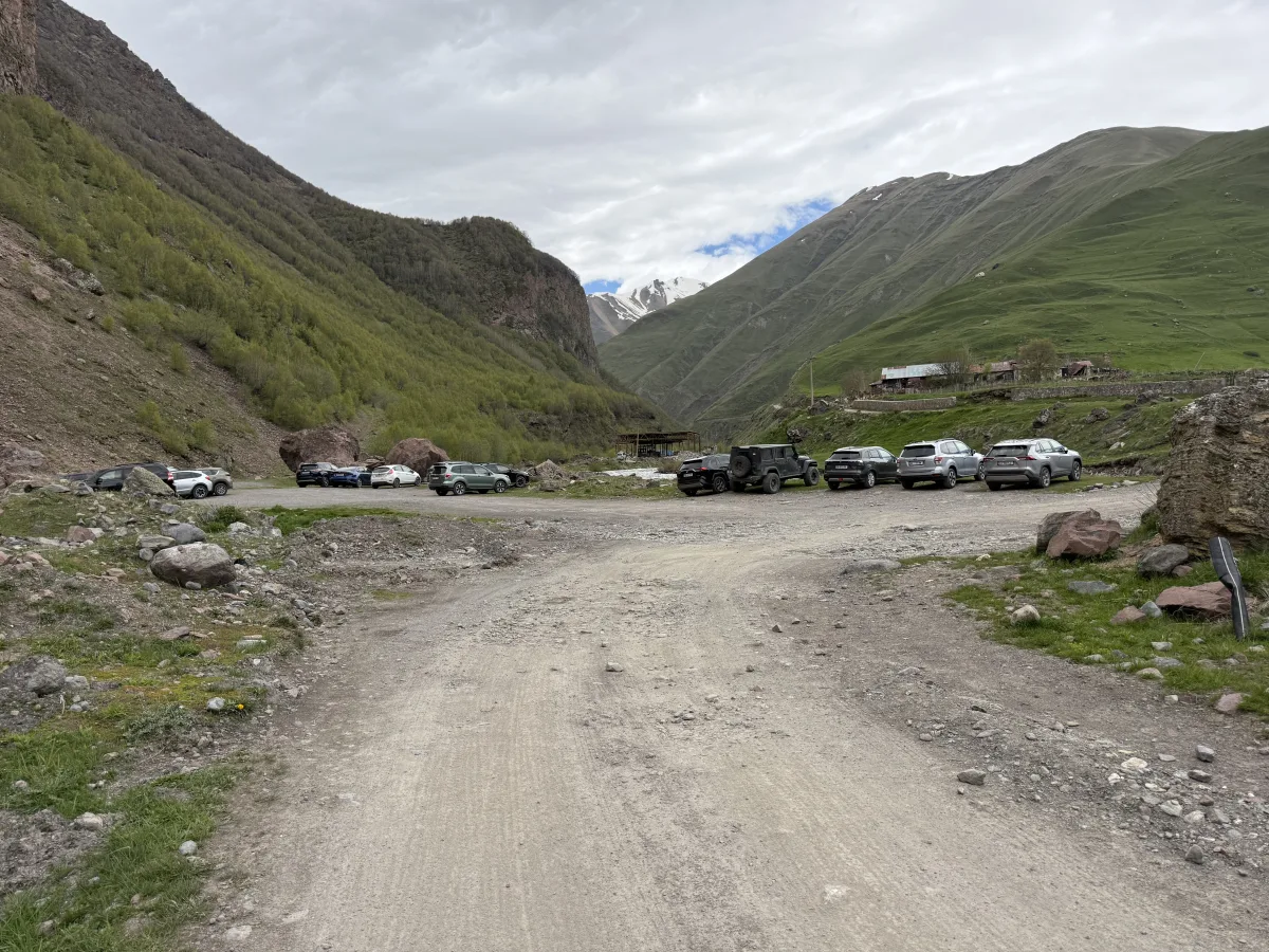
The wide gravel spot where many leave the car before the hike into the valley. If you don’t have a proper off-road vehicle, it’s better to leave the car here on the wide gravel and continue on foot — the stone towers of Ketrisi are a short walk away, and the hardest stretch starts just ahead. This is a normal starting point for hikes deeper into the Truso valley — toward Zakagori fortress and the Abano mineral lakes — so in season it fills with cars: arrive early.
-
08
Climb with ruts
42.5815° N, 44.4649° EBroken Ruts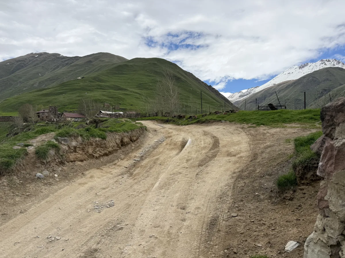
A rutted dirt ramp climbs the grassy shoulder toward the first huts. From this point the road gets much worse. The first challenge is the climb with ruts. In the wet it gets slick — pick the widest line early and take the climb on steady throttle rather than speed.
-
09
Through Ketrisi — stone towers
42.5830° N, 44.4628° EGravel Narrow road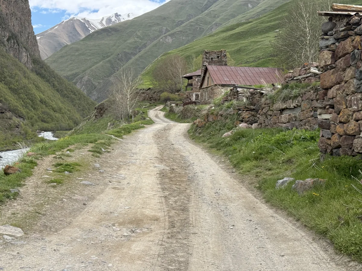
The track squeezes past Ketrisi’s old stone houses and defensive tower. The road narrows to a single lane and runs right past the old stone houses and watchtower of Ketrisi, a stream rushing close on the left. Move at walking pace, watch for people and animals around the yards, and be ready to give way.
-
10
The cut-bank shelf — where the road ends
42.5842° N, 44.4612° EBroken Narrow shelf Loose rock Meltwater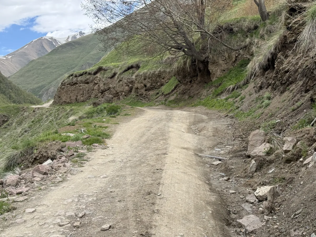
A single-lane dirt shelf cut along a steep earth bank, loose rock on the edge. The road becomes a narrow dirt shelf cut into the bank — a drop on one side, loose rock on the other. There is room for only one car. Sound your horn before blind corners, keep off the crumbling edge, and be ready to reverse for oncoming traffic.
Beyond, toward Zakagori fortress, the track is for prepared high-clearance 4x4 vehicles only — if your car isn’t up to it, turn around here.
Before You Set Off for Truso
Four things to sort out before the Kobi turnoff — there are no services of any kind in the Truso valley.
-
Download offline maps
Mobile signal fades as you enter the Truso gorge and is unreliable deep in the valley. Save the route and the stop coordinates from this guide before you lose coverage.
-
Choose the proper vehicle
Past the gentle opening the track breaks up into rock, ruts, a ford and a narrow shelf — a high-clearance 4x4 is strongly advised. Without one, leave the car in Kobi and ride with a local 4x4 driver.
-
Don’t underestimate the hike
If you park and walk on to Zakagori Fortress, it’s much farther than it looks — allow at least 10 hours for a round trip. Start early, and take water, sun protection and a warm layer.
-
Carry some cash
The few cafés and guesthouses in the Truso valley are cash-only (lari). The nearest ATMs are back on the main road around Kobi and Stepantsminda — withdraw before you turn off.